Visiting : Hurstbridge, Kinglake, Mt Despair
Distance : 125km
When : Sunday 23rd October, 9:30am @ Hurstbridge train station
Where : Click here for route map
Here's a train-friendly ride a bit closer to home. We'll start at Hurstbridge train station and head up to Kinglake via Bowden Spur Rd which is steep and all dirt. Then we'll fly down the other side, dive into the Toolangi State Forest and make our way to the summit of Mt Despair. We'll follow the power lines back towards Kinglake and climb up and over via Captains Creek Rd before rolling back down to Hurstbridge for tea and scones.
This one's relatively short and close to home but there's a significant amount of climbing, largely on dirt. An accessible yet challenging ride.
The full story
That was a long hard day of navigational uncertainty and steep rocky climbs. In short, a typical There Will Be Dirt ride.
Seven of us rolled out of Hurstbridge train station at 9:45am but it wasn’t long before Emma and John decided they’d rather have a cruisy day than a punishing day so they peeled off at the end of Mine Rd and headed off on their own ride.
We got as far as Eagles Nest Road before Martin’s crank arm came loose for the second time so he and Bruce decided to play it safe and turn back to Hurstbridge. Just as well too - Martin has since reported that his crank fell off and he ended up riding one-legged into Hurstbridge. It would have been a long walk home if that had happened deep in the bush.
So, after only 15km the seven starters were reduced to three. When we hit the first climb of the day at 20km it was John on his 29er, me on my 650B rSogn and Matt B, who obviously didn’t get the memo, on his roadie with 23mm slicks.
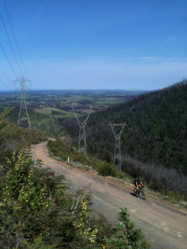
It was hot and sunny and pretty soon we were sweating our way up the gravel of Bowden Spur Road towards Kinglake on what I thought was going to be the hardest climb of the day. Bowden Spur Road follows the powerlines straight up the side of the Kinglake Ranges - the steepest parts hover around 12% and it, mercifully, switchbacks a couple of times before levelling out at the top. We strung out along it and each found our own pace before regrouping at the top.
I kept joking that this was just the warm-up. Turns out I was right.
A quick fuel stop in Kinglake and then we rolled down the other side of the range on Glenburn Rd. What a beautiful road. All downhill, fast, winding corners, hardly any traffic, smooth paved surface. Wunderbar.
It wasn’t long before we popped out the other end at Melba Highway and ducked across it into the Toolangi State Forest. The start of the good bit. This is what we’d come here for. The plan was to follow my carefully researched notes and take dirt roads of varying quality all the way up to the top of Mt Despair. This plan was derailed almost immediately when we followed my notes to the start of “Rocky Track” which looks like this.
It was long, steep and completely unridable. Big, loose rocks made this serious 4WD terrain, not pushbike terrain. It looked like an ankle breaking hike - especially for Matt B in his road cleats - so we backtracked to the trailhead and found a signboard with a map and started working out an alternate route.
Seasonal road closures were marked on the map and we also noted that Mt Despair Road was clearly and emphatically marked “Management Vehicles Only”. Despite lengthy internet research I hadn’t been able to work out definitively if the road up to Mt Despair was actually passable or not. There’s a working fire tower up there and I kinda suspected that it might be behind a locked gate.
Hm...
We decided to get on Marginal Road and head over to Mt Despair anyway.
Just before we left the carpark we saw a couple of trail bikers preparing to hit the trails. Helmets on, goggles adjusted, stupidly loud two stroke engines ripping through the silence. And then one of the bikers whips out an angle grinder and proceeds to cut the end off his brake lever. Wtf?! He saw the disbelieving looks on our faces, gave us a thumbs-up and a grin, slammed the door of his van and then tore off into the bush.
Weird.
So, Marginal Road turned out to be a good choice. It’s a major dirt road that snakes its way through the Toolangi State Forest, climbing up and down hills and crossing various creeks and rivers. Beautiful bushland, awesome views, nice gentle climbs and fast fast descents.
John had taken a photo of the map/signboard in the carpark and he pulled out his camera at dubious intersections so we could get our bearings on the tiny camera screen. Meantime, I’d be trying to get google maps up on my iPhone and John was also trying to correlate the blurry map on his camera with the not-very-detailed map on his Garmin. I think we wasted a lot of time doing this.
We slowly made our way closer to Mt Despair. We could see it in the distance - a flat ridge topped with spindly trees and a small fire tower poking up from the middle of them. We enjoyed the descents and the climbs alike as the sun beat down and we rolled deeper and deeper into the bush. Matt B was descending like a rocket on his roadie but the surface was becoming more and more rocky and eventually he pinch-flatted. 23mm tires at 100psi down rocky descents at speed - I was surprised he made it that far before something gave out. After a quick fix, we took off again and got a little closer to Mt Despair.
After much fooling around at intersections and staring at the map on John’s grimy little camera screen that was getting all slick with sunscreen, we found ourselves coming down a very steep and gnarly descent that had John taking it slow on his 29er, Matt B carefully picking his way down through the rocks under full brakes and me... well, I got off and walked it. I’m a wuss when it comes to gnarly descents like that. To be fair, it must have been pushing 20% and was a mess of big wheel-swallowing ruts and rocks. It was hard enough to walk down it without twisting an ankle.
When we got to the bottom of that gnarly mess we did a map check and realised we’d taken a wrong turn and skirted along the side of Mt Despair rather than hitting it head on. None of us wanted to head back up that gnarly descent - it would have been hike-a-bike for sure - so we looked at the time, cut our losses and decided to start heading back home. Mt Despair will still be there next time. And let’s not forget there’s probably a locked gate at the bottom of it anyway.
And so we began the journey home on the unimaginatively named “SEC Track”.
For all you kids playing at home, “SEC” stands for “State Electricity Commission”. That’s what we used to have before the electrickery was privatised. Anyway, “SEC Track” could mean only one thing - we were going to hit the powerlines again. And hit them we did...
Roads are wonderful things and it’s easy to be ignorant of the amount of planning and thought that goes into their creation. Cartographers, surveyors, geologists, botanists, town planners - a whole wealth of professional knowledge goes into making roads that are not too steep, not too windy, roads that take a somewhat direct route but also respect the laws of private property and maybe even take slight diversions in favour of passing close by a natural spot of beauty or to take in a beautiful view of the countryside.
Powerlines, on the other hand, are brutally simple beasts. They go directly from point A to point B and to hell with whatever’s in the way. Mountains, rivers, private property, virgin bushland, so what! They always have access trails underneath them for maintenance and the access trails are, more often than not, gnarly, gnarly pieces of work.
This “SEC Track” we found ourselves on was no exception.
It obviously sees pretty much no traffic, it was steep (well over 10%), rocky and loose. John - on his 29er MTB - clicked right down and span away smoothly up the hill. I found my lowest gear and tried to follow suit. 42mm slicks weren’t ideal for this terrain but they did an admirable job. No matter what, I kept my butt planted on the saddle to keep weight over the rear tire. I could feel the tire slipping underneath me if I unweighted it even a tiny bit. The surface was very mixed - large rocky sections, washed out eroded ridges, patches of deep gravel - you really had to pick your line carefully if you wanted to maintain traction and keep the power going smoothly through the tires.
John and I reached the top of one particularly gnarly section and waited for Matt B. 23mm slicks at 100psi remember. And with road gearing as well. I don’t know how he did it. He got to the top and said “I just passed the two biggest brown snakes I’ve ever seen.” John and I didn’t see any snakes. “What about that herd of deer?” Nope. Hallucinations? Bloody powerlines...
It was h.o.t.t. hot and we all needed a good sit down and refuel. We spied a road down in the valley below and saw that our powerlines track snaked down to it. After walking down the steepest section (i’m a wuss, the others rode it) we flew down the rest of the hill, jumped a couple of gates and finally got back onto a proper (dirt) road.
We’d returned to civilisation.
We rolled on to Glenburn, inhaled some salty snackage and filled up on water. Then it was straight up the busy Melba Highway before turning off onto Glenburn Road for the climb back up to Kinglake. This was the same road we flew down earlier in the day and I’ve gotta say it was great going back up it too. A nice steady climb, almost no traffic, good road surface. Fantastic.
We saw two echidnas along here. One was ambling across the road, taking his own sweet time. A WRX came flying down the hill and we waved for it to slow down to give the spiky little fella time to get across. The other echidna was half way up the embankment on the side of the road. He snuggled into the dirt as we rolled by, clearly enjoying the heat of the sun on his spiky back.
I tallied up the bad lucks and good lucks as we rolled up the hill. One dead wombat. Two live echidnas. Good luck ride!
Quick water stop at Kinglake and then we hit the main road down to Hurstbridge. Matt B was now on the most appropriate bike for the terrain for a change and he towed John and I home through the lengthening shadows and swarming bugs. There was a train waiting at Hurstbridge as we pulled in so we said quick goodbyes to John (who’d driven to the station) and jumped on the train. It was about 6:30pm.
Job done.
John’s garmin reported 2600m of climbing over 125km. A good solid day.
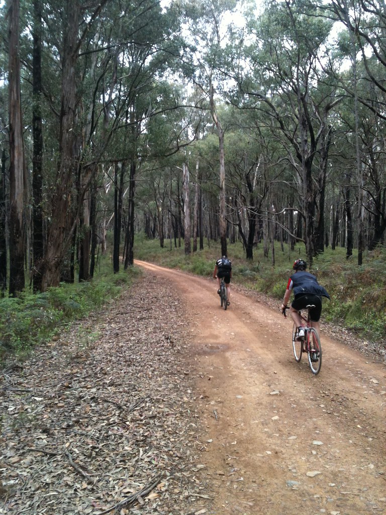
 |
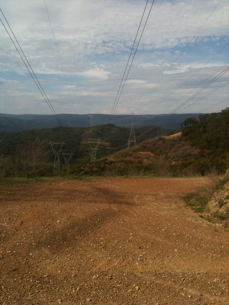
| Bowden Spur Road switchbacks in the distance |
Seven of us rolled out of Hurstbridge train station at 9:45am but it wasn’t long before Emma and John decided they’d rather have a cruisy day than a punishing day so they peeled off at the end of Mine Rd and headed off on their own ride.
We got as far as Eagles Nest Road before Martin’s crank arm came loose for the second time so he and Bruce decided to play it safe and turn back to Hurstbridge. Just as well too - Martin has since reported that his crank fell off and he ended up riding one-legged into Hurstbridge. It would have been a long walk home if that had happened deep in the bush.
So, after only 15km the seven starters were reduced to three. When we hit the first climb of the day at 20km it was John on his 29er, me on my 650B rSogn and Matt B, who obviously didn’t get the memo, on his roadie with 23mm slicks.
 |
| Bowden Spur Road |
It was hot and sunny and pretty soon we were sweating our way up the gravel of Bowden Spur Road towards Kinglake on what I thought was going to be the hardest climb of the day. Bowden Spur Road follows the powerlines straight up the side of the Kinglake Ranges - the steepest parts hover around 12% and it, mercifully, switchbacks a couple of times before levelling out at the top. We strung out along it and each found our own pace before regrouping at the top.
I kept joking that this was just the warm-up. Turns out I was right.
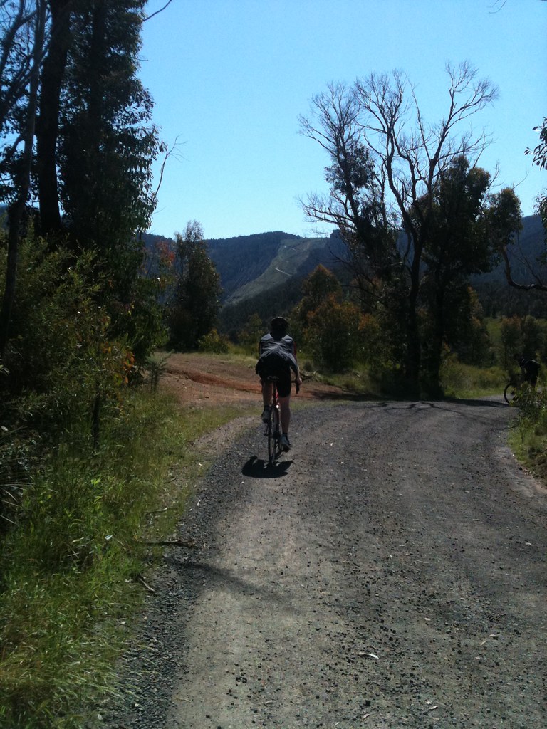
 |
| Finally at the top! |
A quick fuel stop in Kinglake and then we rolled down the other side of the range on Glenburn Rd. What a beautiful road. All downhill, fast, winding corners, hardly any traffic, smooth paved surface. Wunderbar.
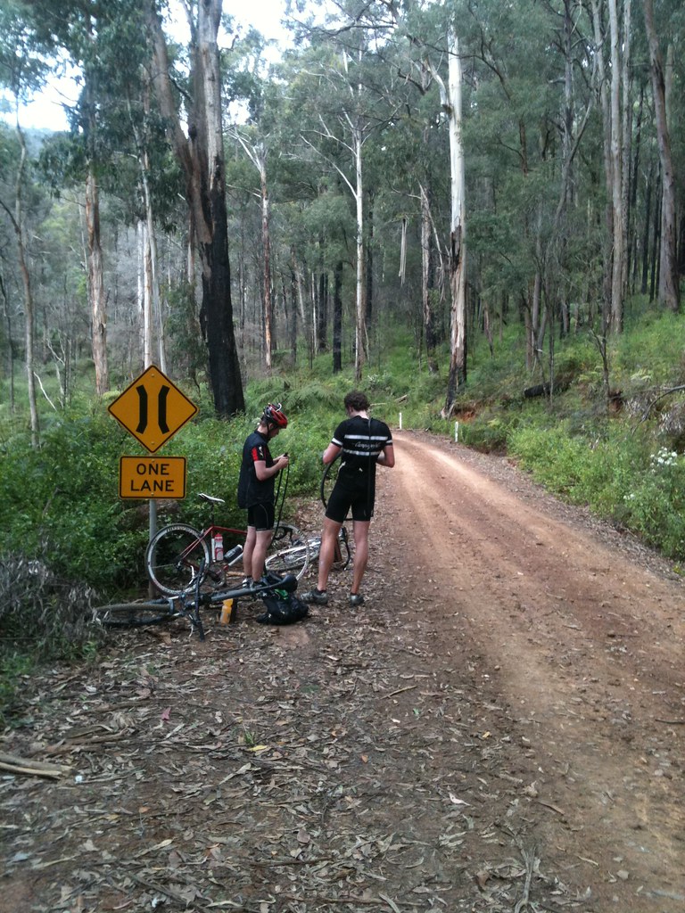
It wasn’t long before we popped out the other end at Melba Highway and ducked across it into the Toolangi State Forest. The start of the good bit. This is what we’d come here for. The plan was to follow my carefully researched notes and take dirt roads of varying quality all the way up to the top of Mt Despair. This plan was derailed almost immediately when we followed my notes to the start of “Rocky Track” which looks like this.
It was long, steep and completely unridable. Big, loose rocks made this serious 4WD terrain, not pushbike terrain. It looked like an ankle breaking hike - especially for Matt B in his road cleats - so we backtracked to the trailhead and found a signboard with a map and started working out an alternate route.
 |
| Toolangi State Forest |
Seasonal road closures were marked on the map and we also noted that Mt Despair Road was clearly and emphatically marked “Management Vehicles Only”. Despite lengthy internet research I hadn’t been able to work out definitively if the road up to Mt Despair was actually passable or not. There’s a working fire tower up there and I kinda suspected that it might be behind a locked gate.
Hm...
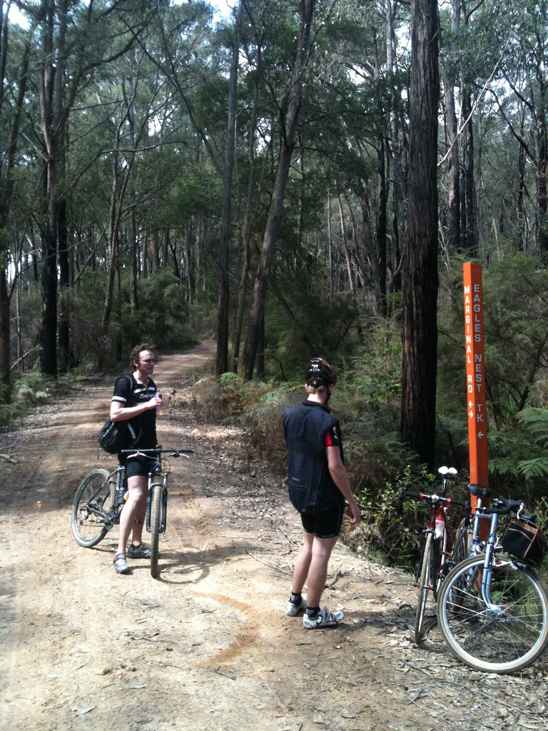
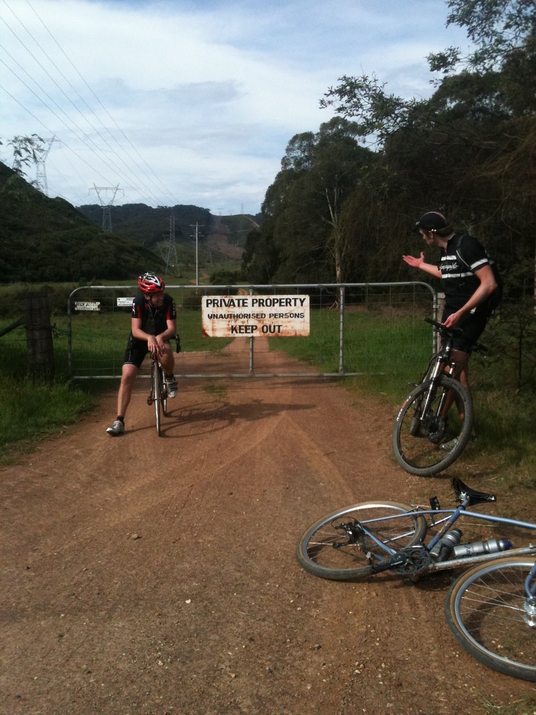
We decided to get on Marginal Road and head over to Mt Despair anyway.
Just before we left the carpark we saw a couple of trail bikers preparing to hit the trails. Helmets on, goggles adjusted, stupidly loud two stroke engines ripping through the silence. And then one of the bikers whips out an angle grinder and proceeds to cut the end off his brake lever. Wtf?! He saw the disbelieving looks on our faces, gave us a thumbs-up and a grin, slammed the door of his van and then tore off into the bush.
Weird.
So, Marginal Road turned out to be a good choice. It’s a major dirt road that snakes its way through the Toolangi State Forest, climbing up and down hills and crossing various creeks and rivers. Beautiful bushland, awesome views, nice gentle climbs and fast fast descents.
 | |
| Water refill in the creek |
John had taken a photo of the map/signboard in the carpark and he pulled out his camera at dubious intersections so we could get our bearings on the tiny camera screen. Meantime, I’d be trying to get google maps up on my iPhone and John was also trying to correlate the blurry map on his camera with the not-very-detailed map on his Garmin. I think we wasted a lot of time doing this.
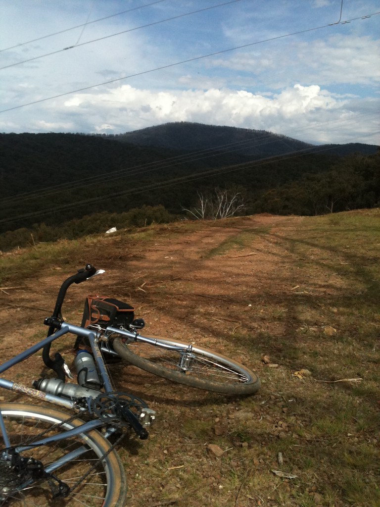
We slowly made our way closer to Mt Despair. We could see it in the distance - a flat ridge topped with spindly trees and a small fire tower poking up from the middle of them. We enjoyed the descents and the climbs alike as the sun beat down and we rolled deeper and deeper into the bush. Matt B was descending like a rocket on his roadie but the surface was becoming more and more rocky and eventually he pinch-flatted. 23mm tires at 100psi down rocky descents at speed - I was surprised he made it that far before something gave out. After a quick fix, we took off again and got a little closer to Mt Despair.
 |
| Pinch flat |
After much fooling around at intersections and staring at the map on John’s grimy little camera screen that was getting all slick with sunscreen, we found ourselves coming down a very steep and gnarly descent that had John taking it slow on his 29er, Matt B carefully picking his way down through the rocks under full brakes and me... well, I got off and walked it. I’m a wuss when it comes to gnarly descents like that. To be fair, it must have been pushing 20% and was a mess of big wheel-swallowing ruts and rocks. It was hard enough to walk down it without twisting an ankle.
When we got to the bottom of that gnarly mess we did a map check and realised we’d taken a wrong turn and skirted along the side of Mt Despair rather than hitting it head on. None of us wanted to head back up that gnarly descent - it would have been hike-a-bike for sure - so we looked at the time, cut our losses and decided to start heading back home. Mt Despair will still be there next time. And let’s not forget there’s probably a locked gate at the bottom of it anyway.
And so we began the journey home on the unimaginatively named “SEC Track”.
For all you kids playing at home, “SEC” stands for “State Electricity Commission”. That’s what we used to have before the electrickery was privatised. Anyway, “SEC Track” could mean only one thing - we were going to hit the powerlines again. And hit them we did...
 | |
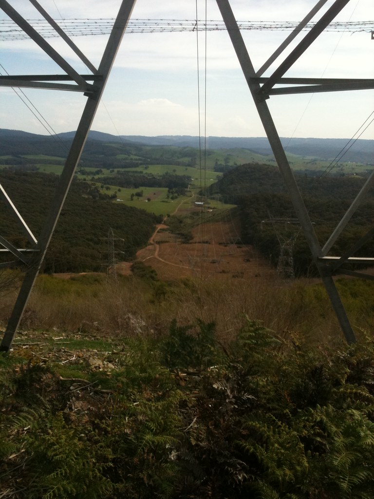
| Mt Despair in the distance |
Roads are wonderful things and it’s easy to be ignorant of the amount of planning and thought that goes into their creation. Cartographers, surveyors, geologists, botanists, town planners - a whole wealth of professional knowledge goes into making roads that are not too steep, not too windy, roads that take a somewhat direct route but also respect the laws of private property and maybe even take slight diversions in favour of passing close by a natural spot of beauty or to take in a beautiful view of the countryside.
Powerlines, on the other hand, are brutally simple beasts. They go directly from point A to point B and to hell with whatever’s in the way. Mountains, rivers, private property, virgin bushland, so what! They always have access trails underneath them for maintenance and the access trails are, more often than not, gnarly, gnarly pieces of work.
This “SEC Track” we found ourselves on was no exception.
 |
| Powerlines don't care |
It obviously sees pretty much no traffic, it was steep (well over 10%), rocky and loose. John - on his 29er MTB - clicked right down and span away smoothly up the hill. I found my lowest gear and tried to follow suit. 42mm slicks weren’t ideal for this terrain but they did an admirable job. No matter what, I kept my butt planted on the saddle to keep weight over the rear tire. I could feel the tire slipping underneath me if I unweighted it even a tiny bit. The surface was very mixed - large rocky sections, washed out eroded ridges, patches of deep gravel - you really had to pick your line carefully if you wanted to maintain traction and keep the power going smoothly through the tires.
John and I reached the top of one particularly gnarly section and waited for Matt B. 23mm slicks at 100psi remember. And with road gearing as well. I don’t know how he did it. He got to the top and said “I just passed the two biggest brown snakes I’ve ever seen.” John and I didn’t see any snakes. “What about that herd of deer?” Nope. Hallucinations? Bloody powerlines...
 |
| Our road snaking away into the distance |
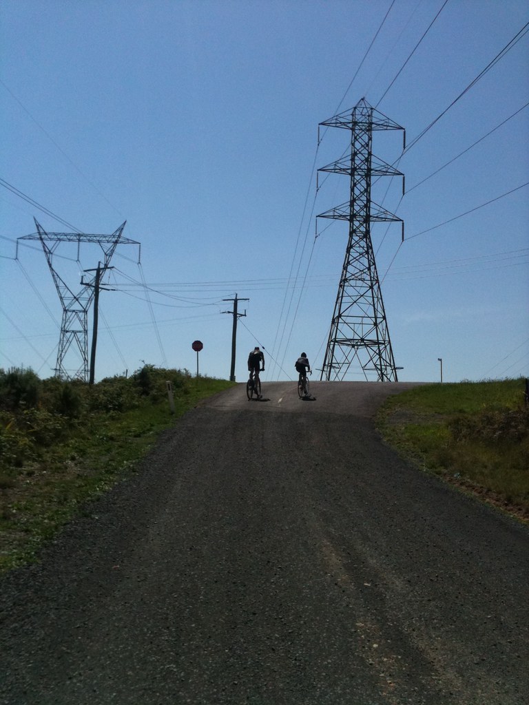
It was h.o.t.t. hot and we all needed a good sit down and refuel. We spied a road down in the valley below and saw that our powerlines track snaked down to it. After walking down the steepest section (i’m a wuss, the others rode it) we flew down the rest of the hill, jumped a couple of gates and finally got back onto a proper (dirt) road.
We’d returned to civilisation.
 |
| Back to civilisation |
We rolled on to Glenburn, inhaled some salty snackage and filled up on water. Then it was straight up the busy Melba Highway before turning off onto Glenburn Road for the climb back up to Kinglake. This was the same road we flew down earlier in the day and I’ve gotta say it was great going back up it too. A nice steady climb, almost no traffic, good road surface. Fantastic.
We saw two echidnas along here. One was ambling across the road, taking his own sweet time. A WRX came flying down the hill and we waved for it to slow down to give the spiky little fella time to get across. The other echidna was half way up the embankment on the side of the road. He snuggled into the dirt as we rolled by, clearly enjoying the heat of the sun on his spiky back.
I tallied up the bad lucks and good lucks as we rolled up the hill. One dead wombat. Two live echidnas. Good luck ride!
 |
| Fast rolling to Glenburn |
Quick water stop at Kinglake and then we hit the main road down to Hurstbridge. Matt B was now on the most appropriate bike for the terrain for a change and he towed John and I home through the lengthening shadows and swarming bugs. There was a train waiting at Hurstbridge as we pulled in so we said quick goodbyes to John (who’d driven to the station) and jumped on the train. It was about 6:30pm.
Job done.
John’s garmin reported 2600m of climbing over 125km. A good solid day.
>> Click here for more photos <<
No comments:
Post a Comment
Note: Only a member of this blog may post a comment.