
Visiting : Licola, Wonnangatta Valley, Dargo High Plains Road
Distance : 294km
When : Wednesday 29th May, 9:00am
Where : Click here for route map
I had a milestone birthday coming up so we decided to take the family to Bright for a long weekend of food, booze and chasing the kids around. I figured I’d do a single day ride while we were up there but someone floated the idea of me riding up the day before, camping somewhere and then meeting up the next day in Bright. Works for me! So, I plotted a course from Traralgon to Bright that would take me up a road I’d had my eye on for a couple of years now - Dargo High Plains Road.
Finally, I’d get to ride it.

I’d been bitten by the bikepacking bug pretty hard just when we were expecting our second child so I’d been researching gear, buying gear, reading so many stories of multi-day adventures, doing pretty much everything except actually riding! This was to be my first bikepacking trip and first decent ride since little Lillian was born. To say I was looking forward to it is an understatement. The anticipation was killing me!
 |
| Flat road out of Traralgon |
I caught the first v-line train of the morning to Traralgon. Nice and empty to begin with but it filled up with high school kids later on and then a trio of likely lads in suits on their way to a court case, loudly talking about who was “going in”, who’d just “got out” and who they were going to “smash”. Eventually we got to Traralgon, I picked up a coffee and couple of croissants and hit the road out of there.
It was easy rolling on paved roads for the first 100km or so. Not much to report from that section - it was flat, dry, not much traffic, good country roads for the most part. I just tapped away and looked over my shoulder every now and then to see the smokestacks of Traralgon receding further and further into the distance.
 |
| Falcon ready to swoop |
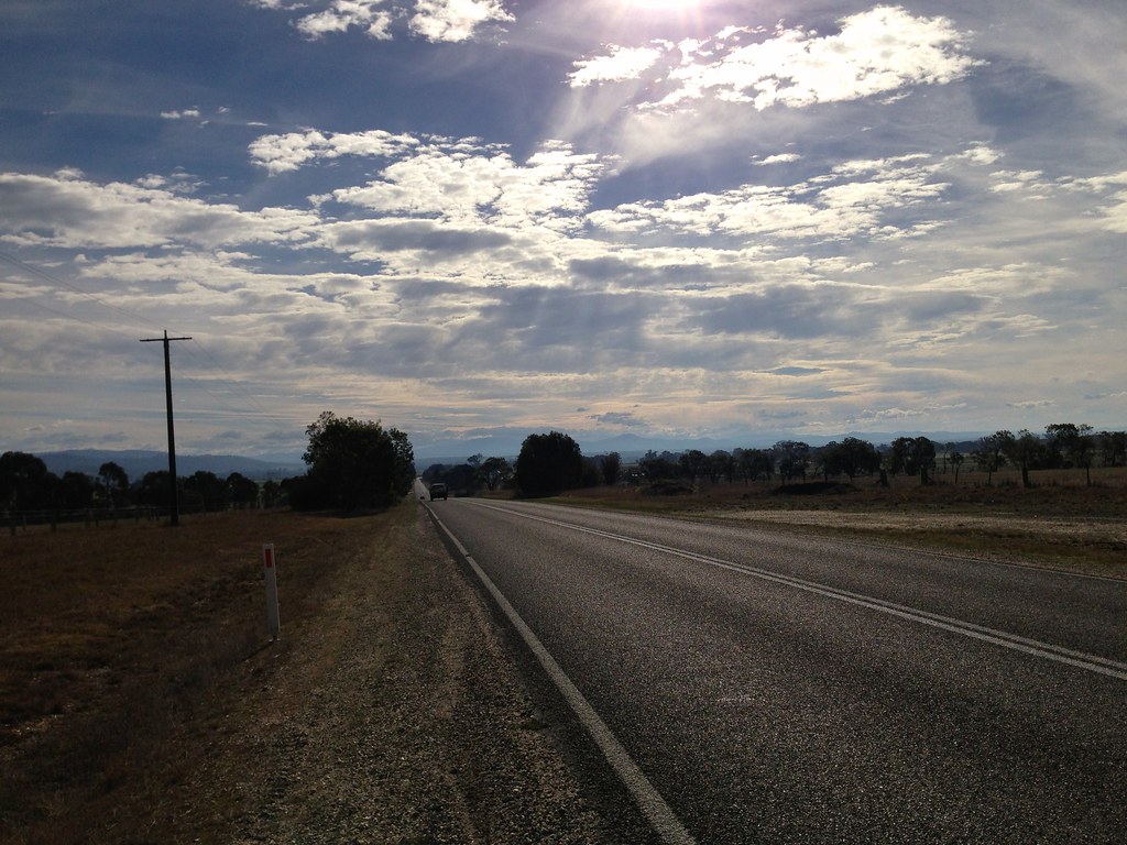
The road got more interesting the further out it went and soon I was having a breather on top of Blanket Hill, looking back at the smokestacks far in the distance, Lake Glenmaggie back to the left, and the wide flat plains of Gippsland spreading out to the horizon. After Blanket Hill I said goodbye to all that and continued north, straight into the hills towards my first, and only, refuel point at Licola.
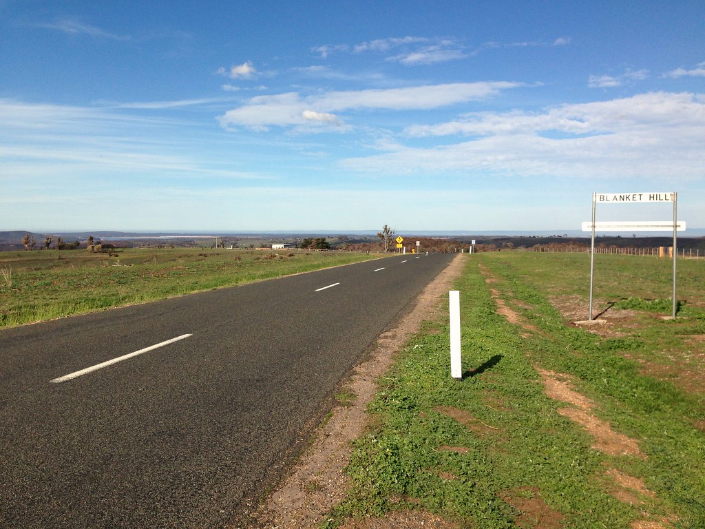 |
| Lake Glenmaggie on left, Traralgon in distance |
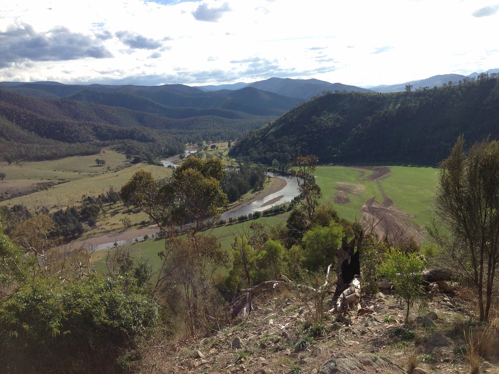
Big hills as far as the eye could see, big rivers winding through green valleys, huge rocky outcrops and winding roads snaking around bushfire-scarred hillsides. Nice.
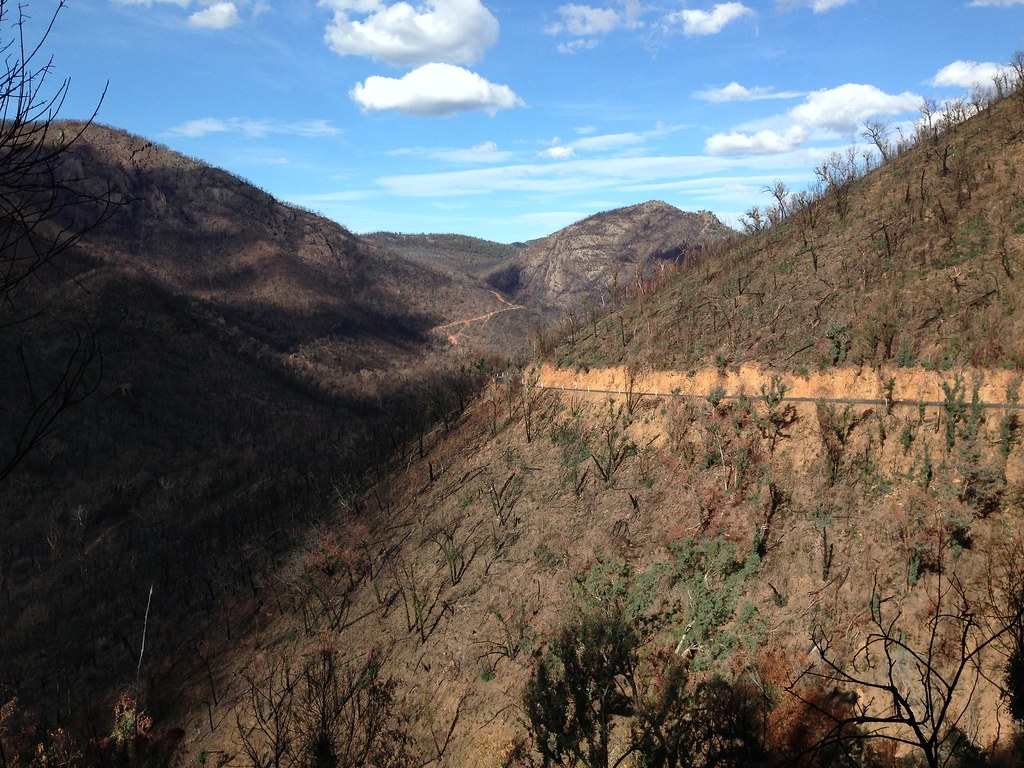 |
| Jamieson-Licola Road |
I stocked up on food at the shop in Licola and kicked off my shoes for a good sit-down.


Just as I got ready to roll out I heard some yelling across the river and saw a guy in a ute starting to herd a big mob of sheep over the bridge, barking orders at his two dogs who were darting around and keeping the herd in tight formation. Only one road out of town and it looked like I’d have to wait my turn to use that bridge so I sat back and enjoyed the show. All in a day’s work for the dogs and man, I’m sure, but I was impressed nonetheless. The man directed the dogs from the driver’s seat of his ute and the dogs moved the sheep as one right down the main street of Licola. A straggler broke away and headed for the public toilets but, in a flash, the dogs were on it and in no time he was back in the herd, shuffling and pushing down the road past the store with the rest of his mates, dogs nipping at their heels, man hanging out the window of his ute barking orders and rolling slowly down the street after them.
 |
| Sheep on the bridge |
When they’d passed, I rolled back over the bridge and cut immediately left onto Tamboritha Road, into the bush. No more shops until the next day in Harrietville, just rivers, springs, huts, dirt roads and tracks up into the high country.
I rolled up Tamboritha Road past a whole bunch of numbered camping areas which looked well used but were currently all vacant. Must see a lot of traffic in the warmer months.

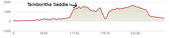
Just after the last camping area, I filled up water at Wellington River and started the first proper climb of the day - a solid 1000 metre climb up to Tamboritha Saddle.
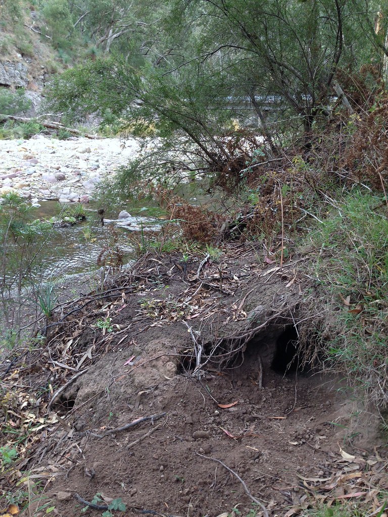 |
| Wombat lives here |
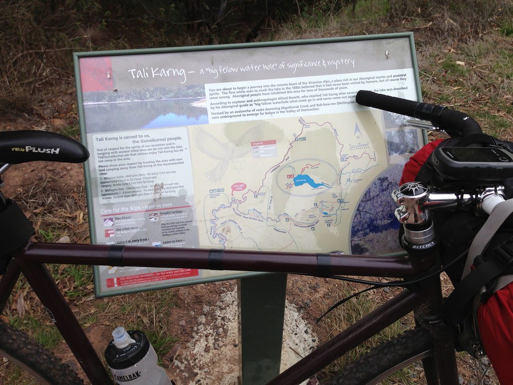 |
| Lake Tali Karng. One day... |
Nice wide dirt road, beautiful surface, steady gradient, just keep turning the legs over and watch the views get more and more spectacular.
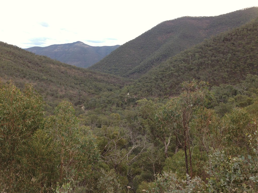


My phone sprang into life at Bennison Lookout so I called my wife to check in and say hi. I’d been planning to call from Licola but I had no reception there. “Hi, it’s me! What’s that? Serious?! Oh man, not again!” Her mobile phone was missing, presumed dead. Staying in touch was going to prove tricky - I’d have patchy coverage for the rest of the ride and we’d have no easy way of communicating after she left the house to drive to Bright the next day. Oh well, we’d just have to deal.
 |
| Bennison Lookout |
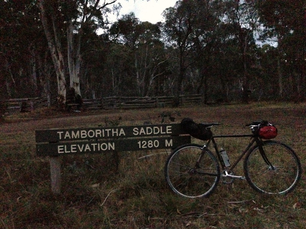
The sun was setting as I topped Tamboritha Saddle and rolled on into the darkness, helmet light blazing, feeling pretty damn good about everything.
Just after dark was the best time for animals. I only saw one or two vehicles after the sun went down but I was certainly not alone out there. In the first part of the day I’d seen plenty of roadkill on the paved roads - now the scales were tipped the other way and the bush came alive with all sorts of creatures.
Tiny bats swooped around the periphery of my light. Fuzzy black wallabys lolloped off the road as I freewheeled past. Wombats snuffled around on the side of the road, some trundling off into the undergrowth when they saw me, others deciding to run down the road ahead of me so that I’d slow down and follow them for what felt like 20-30 metres before they finally veered off and started crashing through the bush.
I’m used to the sound of roos and wombats fleeing into the bush as I pass. It can be a bit surprising at first because, if you’re going the right speed, they notice you when you’re right on them and start bolting through the trees right next to you as you fly by. Can make quite a sudden and loud racket. Deer are a lot louder.
I’ve seen deer before on other rides but I’ve never seen so many, so close and so large as I did on this ride. And when you startle them and they bolt into the bushes it sounds like a monster truck is smashing down the trees as you pass. A couple of times I instinctively whipped my head around, half expecting that a runaway 4WD was about to burst onto the road and run me down from behind.
I saw plenty of deer and I’m sure I passed many more that I didn’t see. My visibility was limited to the cone of light from my helmet light which was, understandably, glued to the road for the most part, picking out a path on the dirt road, finding the smooth line and trying to avoid the pinch-flat inducing rocks that jutted out randomly. A couple of times I came flying down a hill, found a nice smooth section that allowed me to take my eyes off the road for a second and turned my head to the left only to see the massive shape of a deer right next to me, lifting its head up from the scrubby grass on the side of the road, eyes glowing as the thought “WTF?!” slowly formed in its head, by which time I was already gone, freewheel buzzing down the hill, a huge grin on my face, possibly calling out “Yeeeeeew!” and hopping rocks, floating over corrugations, looking for the next smooth line.
 |
| Rest break |
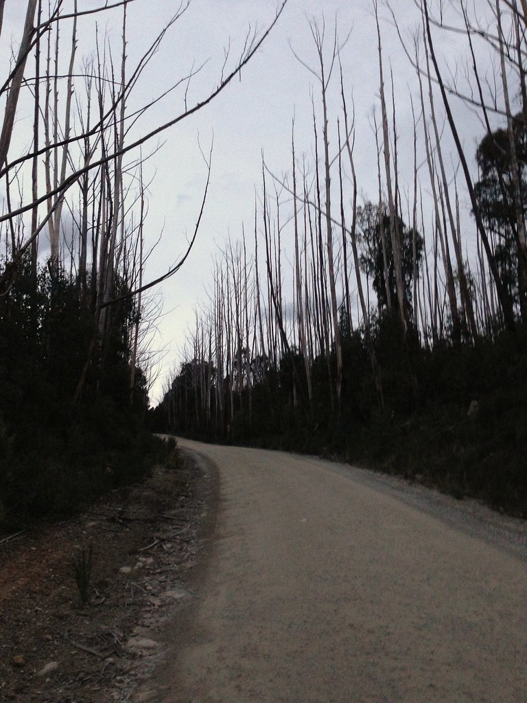
The road continued like this for 50km or so, rising, falling, always staying above 1000 metres. The temperature dropped but it didn’t feel that cold. Short-sleeved merino jersey, merino arm warmers, shorts. I had a few sit-down breaks on the side of the road and put on my puffy jacket so I didn’t cool down too much, then took it off after I’d started riding again. I don’t remember bad winds on this section - it was pretty sheltered by the terrain and thick tree cover for the most part - and it was still bone dry so it was great night riding conditions. I did sometimes glimpse a break in the trees out of the corner of my eye and try to shine my helmet light out to see what I could see but, of course, my light just threw out into empty space and didn’t hit anything. I knew I was riding through high plains country but I couldn’t tell you if there were great views or not. All I saw was the road.
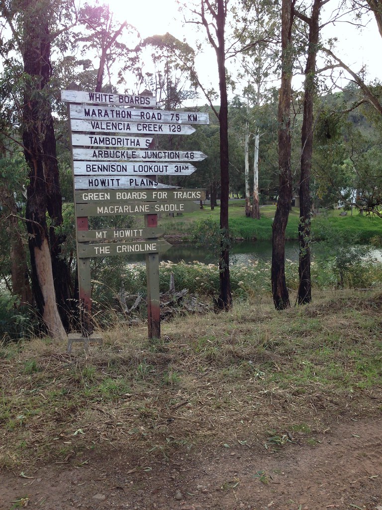
I nibbled food regularly and ticked off various landmarks that I’d memorised. Arbuckle Junction. McFarlane Saddle. Moroka Track. Water was getting quite low when I finally arrived at the bridge over Moroka River. I carried a 2L bladder and one bidon and had almost emptied them both since my last refill at Wellington River at the base of the big climb up Tamboritha Road. This was in mild weather at the end of the day - on a hot day you’d really want to carry more water than that, I think. Or look harder than I did for another water stop before Moroka River.
Anyway, I walked out onto the bridge over Moroka River and shone my light around trying to find the best spot to get down the bank and fill up water. Turns out helmet lights are great for spotlighting night fish! The river was shallow and if I shot my beam straight down it lit up the river all the way to the bottom and, in this case, lit up a fat black fish about 30-40cm long. I described it to my father-in-law a week later and he said “Yeah, a Blackfish.” So there you go.
I scraped and stumbled down the bank and used my bidon to transfer water into the bladder - less clumsy than trying to hold a floppy bladder under the water while trying not to get hands or feet wet. I didn’t use a cloth filter or anything, just popped a couple of Aquatabs in the bladder and bidon after they were both filled to capacity. Also made a note of the time as the Aquatabs need 30 minutes to do their magic.
Refill complete, I ate more food and rolled on into the night, though with less enthusiasm than earlier. I was starting to feel tired and, now that I had enough water to bivy up for the night, my thoughts started turning to possible camping spots. I’d originally planned to get a lot further along the road before stopping for the night but what can I say? The fatigue was upon me and I knew I’d be ready to stop soon. I talked myself into going just a bit further, just a bit further.
“Horseyard Flat is just up the road, I can easily get to that.”
“Well, if you can get to Horseyard Flat, then it’s just a little bit further to the bridge over Little River.”
“If we get to Little River then it’s only a few more k’s to The Pinnacles.”
And so I kept rolling until I reached the turnoff to The Pinnacles which is a big rocky outcrop with a fire tower and an amazing view. Well, in daylight only, of course. I briefly considered bivying at the fire tower but talked myself out of it by saying “Well, if you can get to The Pinnacles then you can get down Billy Goat Bluff Track to the bottom of the valley.” And I planned to be up and rolling before dawn anyway so I figured that I wouldn’t be able to appreciate the awesome views from the tower and decided to keep rolling towards Billy Goat Bluff Track.
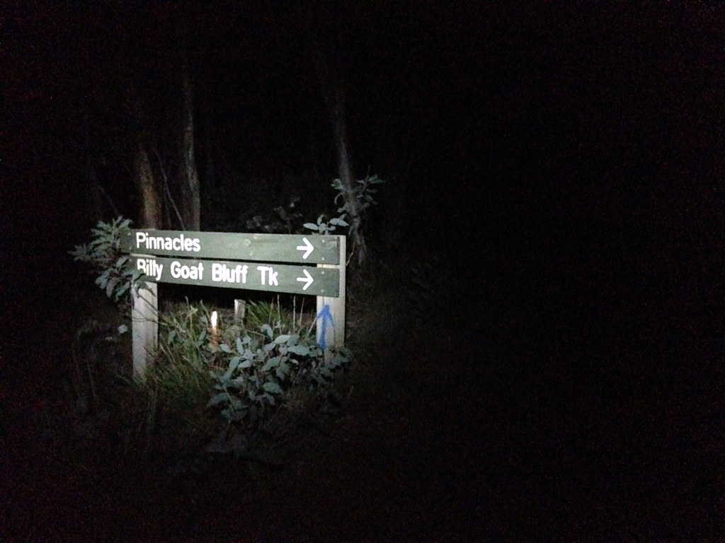
Billy Goat Bluff Track is one of the iconic Victorian high country 4wd tracks. It goes from just near The Pinnacles - about 1400 metres - down to the Wonnangatta Valley at about 250 metres - in just about 7km. It’s steep, narrow, rocky and loose. I’d already prepared myself for the possibility of hiking down it and, upon seeing it up close, it was obvious that that is exactly what I’d have to do.
 |
| Billy Goat Bluff Track. Chunky |
It was steep, rutted and carved up, big chunky rocks, ledges, the whole shebang. I was running 35mm knobbies and rim brakes, it was dark, I was tired. I started riding down slowly, trying to carefully pick my way down, but I could see it was going to end in tears. So, I started stumbling down it on foot, cleats scraping and sliding through loose rubble, ankle breaking rocks and whatnot. Bah, too tired for this shenanigans - I decided to save it for the morning and started scouting around for a flat spot of ground. There wasn’t much to choose from but I managed to scrape away the rocks and rubble in a small nook just off a narrow, exposed section of the track and began to set up camp for the night.
I felt clumsy as hell setting up camp. First time I’d actually used any of this gear and, because I was on an exposed section of ridge, high above the Wonnangatta Valley, the wind was howling. I’d brought a change of clothes for sleeping and so I staggered around in the pitch black, trying to change out of my knicks and into my pj’s, tiptoeing gingerly on the sharp rocky ground, butt naked in the howling wind, trying to quickly get changed while not losing anything over the edge where it’d disappear into the valley below never to be seen again, one foot on my bivy bag, trying to keep it anchored to the ground while I clumsily sorted out all my crap and awkwardly squirmed into the sack like a drunk snake trying to get back into its skin.


Once inside, I was toasty warm. -5C down sleeping bag, cushy four season inflatable mat, beefy mountain climber’s bivy bag - I could have been lying on ice and snow and I’d still have been toasty. I was prepared for the worst - snow, ice, rain - but it turns out the main problem I had that night was just getting comfortable in the tight confines of the bag while lying flat on my back and clumsily trying to drink water and eat muesli bars without choking on them. I was sure that I’d get a puncture in my sleeping mat - the ground was all sharp rocks despite my clearing efforts, so I tried not to move around too much.
When I settled down, I had some fitful sleep. Bivy worked great - the wind was very strong but everything stayed put. I stared up at the clouds racing across the moon. I could hear the wind gusting hard and felt it pushing insistently on my bag. It rained a little bit but nothing substantial. When the wind lulled, I may have heard animal sounds. Mostly it was just the moon. Three quarter moon. Just staring up into the blackness and seeing broken clouds racing across the moon. Dozing a little. Waking when the wind gusted up again. Midnight ticked over at some point.
“Heh... I just turned 40.”
To be continued...
So many memories.
ReplyDeleteScout camps, hiking into Lake Tali Karng from MacFarlanes' Saddle.
High School camps at Tamboritha in the schools Chalet.
You'll have to go bush one day up there. You've missed out on Guy's Hut, Gillios Track into Tali Karng - good times.
Yep, Tali Karng is def on my list. Love to take my trail runners next time and do a few side trips on foot. So many possibilities...
ReplyDeleteHey, that's amazing - I did a really similar route in March with a friend. Started at Traralgon, up through Licola, camped near Kelly's Hut on the first night. Intended to go up to Howitt and down the Zeka Spur, but reassessed, and went down Moroka Rd and the Billy Goat Bluff Track, just sneaking in to Dargo for a hot dinner.
ReplyDeleteDay 3, we were followed for 50km up the Dargo High Plains Rd by a Jack Russell - impressive! My mate broke a pedal on a crash, so had to alternate forward and backward strokes for the rest of the trip. Camped just short of the Hotham Rd - awesome view.
Day 4, the road down through Harrietville was closed (bushfire debris clearing), so went the back way via Twins Jeep Track, which turned out to be absolutely stunning, connecting up eventually with Buckland Valley Rd, then in to Bright. The last day we rolled out along the rail trail then through Milawa.
Some photos here: http://www.flickr.com/photos/felixdance/8612142961/in/photostream/